| Quick Facts: | Lake Nyasa |
|---|---|
| Countries: | Malawi Mozambique Tanzania |
| Type: | Rift lake |
| Surface area: | 29.600 km2 (11.400 sq mi) |
| Max. width: | 75 km |
| Max. length: | 560 km to 580 |
| Surface elevation: | 500 meters above sea level |
| Max. depth: | 706 m |
| Average depth: | 292 m |
| Water volume: | 8.400 km³ |
| Primary outflows: | Shire River |
| Primary inflows: | Ruhuhu River |
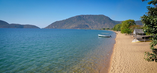
Lake Nyasa (or Nyassa; from the Bantu word nyanza, meaning “great water”), also called Lake Malawi is the southernmost and third largest of the lakes of the Great Rift Valley of eastern Africa. It is bordered by Tanzania on the northeast, Mozambique on the east, and Malawi on the west and south.
It is 360 miles (580 km) long and from 15 to 50 miles (24 to 81 km) wide. Its surface is 1,550 feet (470 meters) above sea level, but its deepest point (2,580 feet, or 790 meters), near the northern end, is about 700 feet (210 meters) below sea level. The water in the lake is fresh and drinkable, being fed by numerous short streams from the surrounding mountains and plateaus.
The Portuguese knew of Lake Nyasa from 1616, and a Portuguese claimed to have seen it in 1846. The first accurate description came from David Livingstone and John Kirk in 1859.The lake was reached farther north by Albrecht Roscher a few months later. The first shots of World War I between British and German forces were exchanged on the eastern shores of Lake Nyasa on Aug. 6, 1914, when a British vessel captured a German gunboat at Mbamba Bay (Sphinx-haven).


