| Quick Facts: | Lake Albert |
|---|---|
| Countries: | Democratic Republic of Congo Uganda |
| Area: | 5.300 km² (2.046 mi²) |
| Avg. Depth: | 25 m |
| Max. Depth: | 58 km |
| Surface elevation: | 615 m (2.018 ft) |
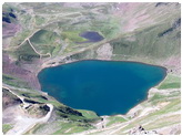
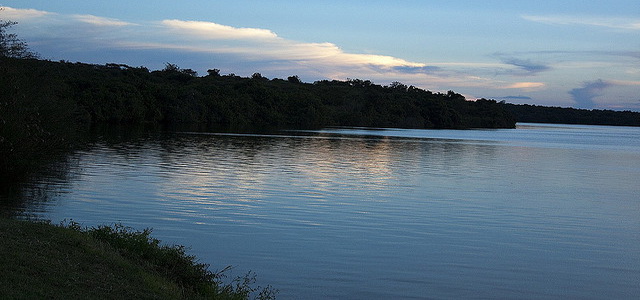
Lake Albert is a body of water in central Africa, located between Uganda on the east and the Democratic Republic of the Congo on the west. It is also known as Lake Mobutu Sese Seko.
Albert Lake is part of the Great Rift Valley, a depression that extends southward to Lake Tanganyika and northward across the Red Sea basin into Asia. The lake is about 100 miles (160 km) long and 20 miles (30 km) wide, and has an area of 2,064 square miles (5,300 sq km). It lies within the basin of the Nile River, 2,200 feet (670 meters) above sea level.
It has few natural harbors. At the southwestern end, it is fed by the Semliki River, which issues from Lake Edward. At the northeast end, it receives the Victoria Nile just below Murchison Falls. Albert Lake’s outlet is the Albert Nile, known as Bahr el Jebel when it enters Sudan on its way north to form the White Nile.
Discovery
The British explorers John Hanning Speke and James Augustus Grant traveled near Albert Lake in 1862, although they did not see it. Acting on their information, the English explorer Sir Samuel Baker found the lake in 1864. Baker named it for Prince Albert, consort of Queen Victoria. The Italian explorer Romolo Gessi sailed around Albert Lake in 1876, and the German-born traveler Mehmed Emin Pasha (Eduard Schnitzer) did so eight years later.